For our last day in Luxembourg, Mitchell and I decided to do a AllTrails tour of Luxembourg which turned out to be fantastic. I will definitely be doing more of these AllTrails tracks through cities to see the sights.
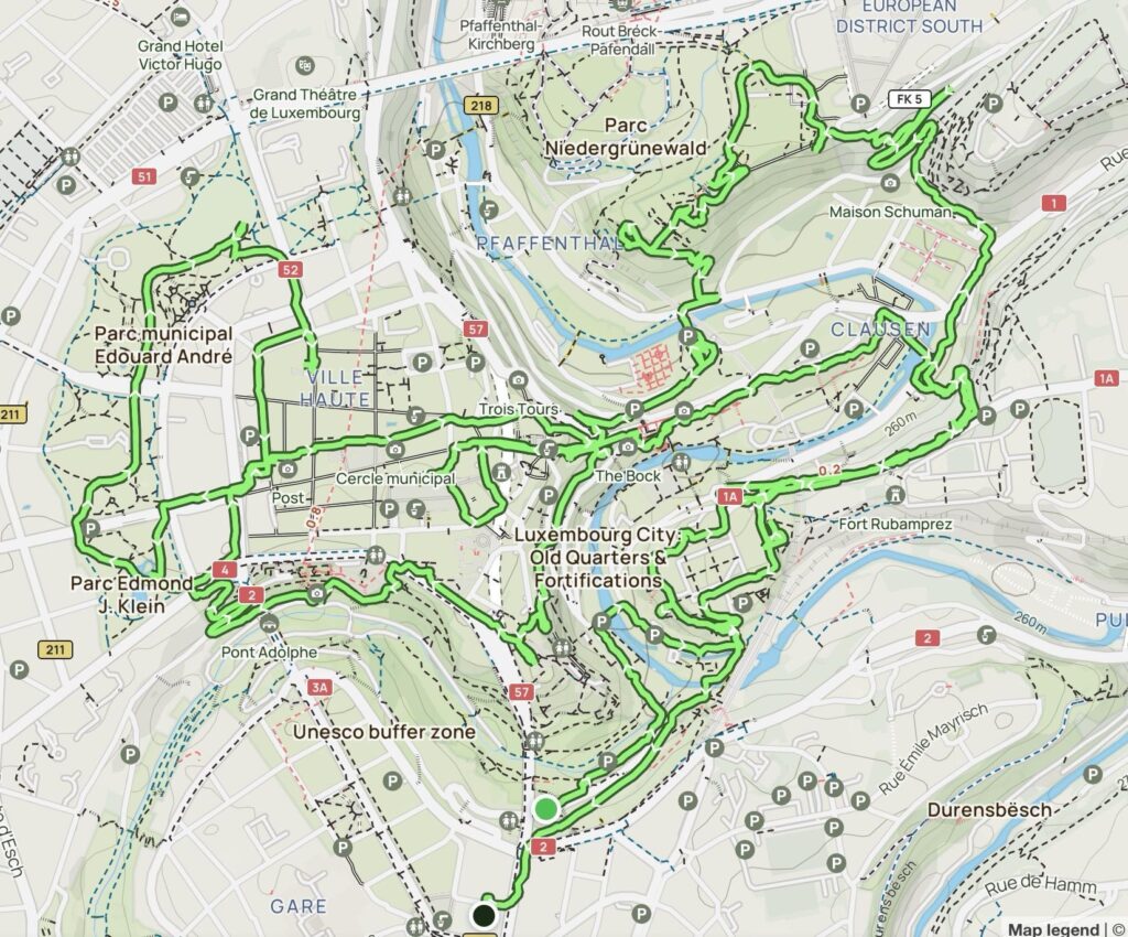
We made our way once again into the central station on the free public transport network. I began our route through and around the city and by the end of the day we decided to double back and check things out again. It was that good. Below is a map we took which totalled 15.38km. We were walking from 10:15am and concluded our travels at 6:00pm. We had a few breaks and casual detours along the way.
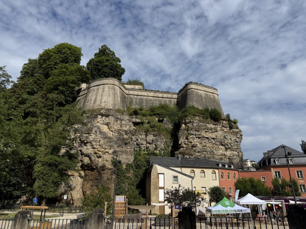
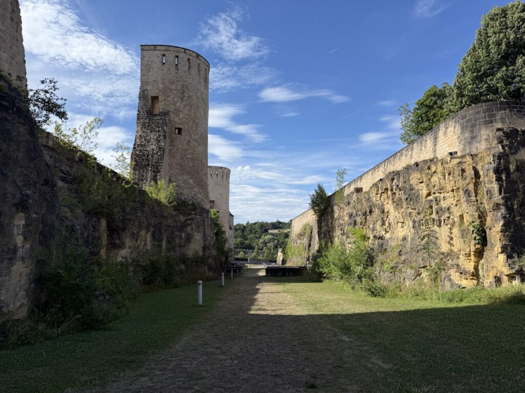
Luxembourg has so many old fortifications to see. Houses are set below great cliffs and walls and I wondered at times as we walked beneath them what would happen if a rock fell on their homes? Mitchell told me bluntly, “well they would have to repair their roof”. Obviously.
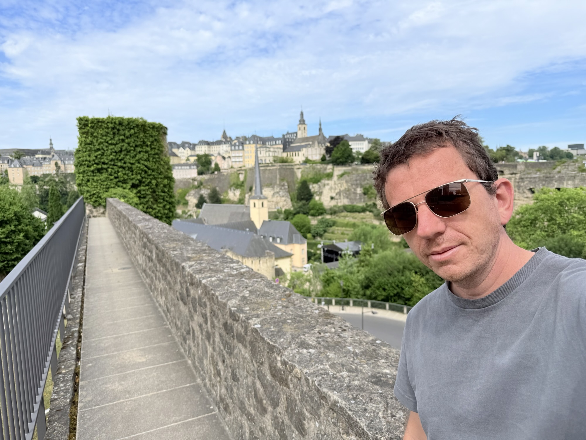
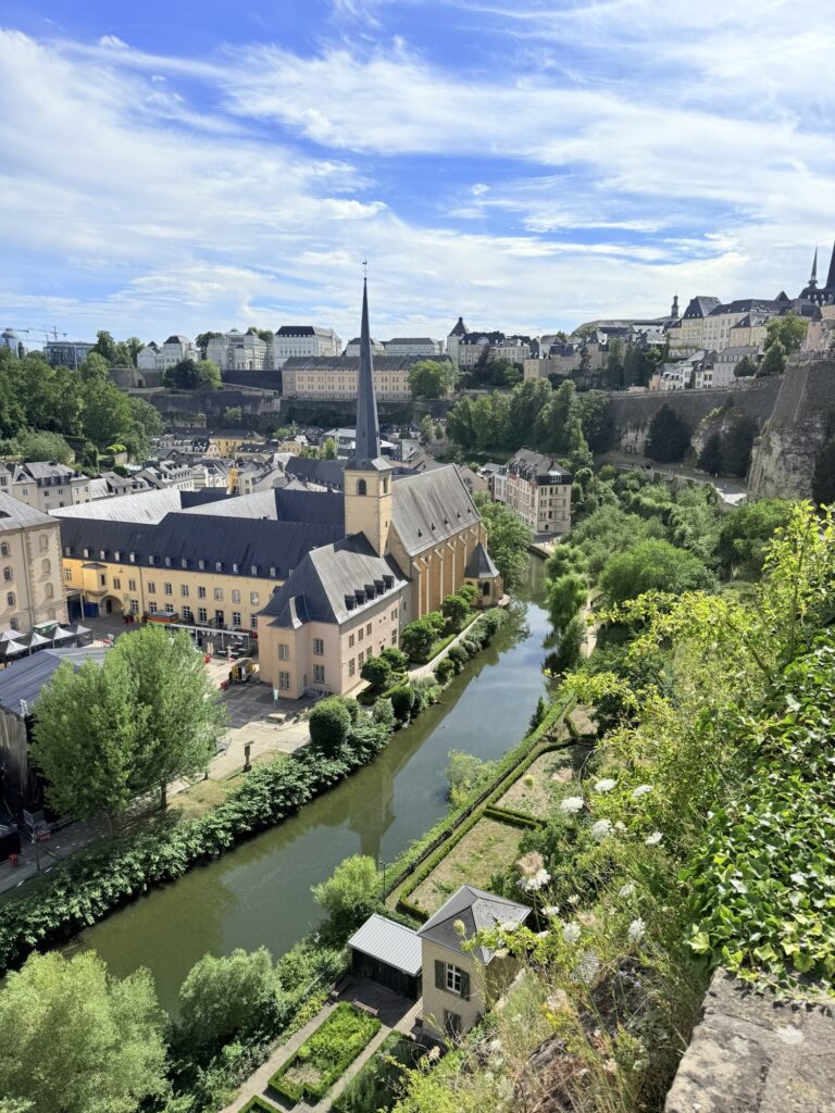
We got to see the Ville Haute (Ville Haute is underlined, you can click it like other links in this post) from a height on this walk which is in the image below.
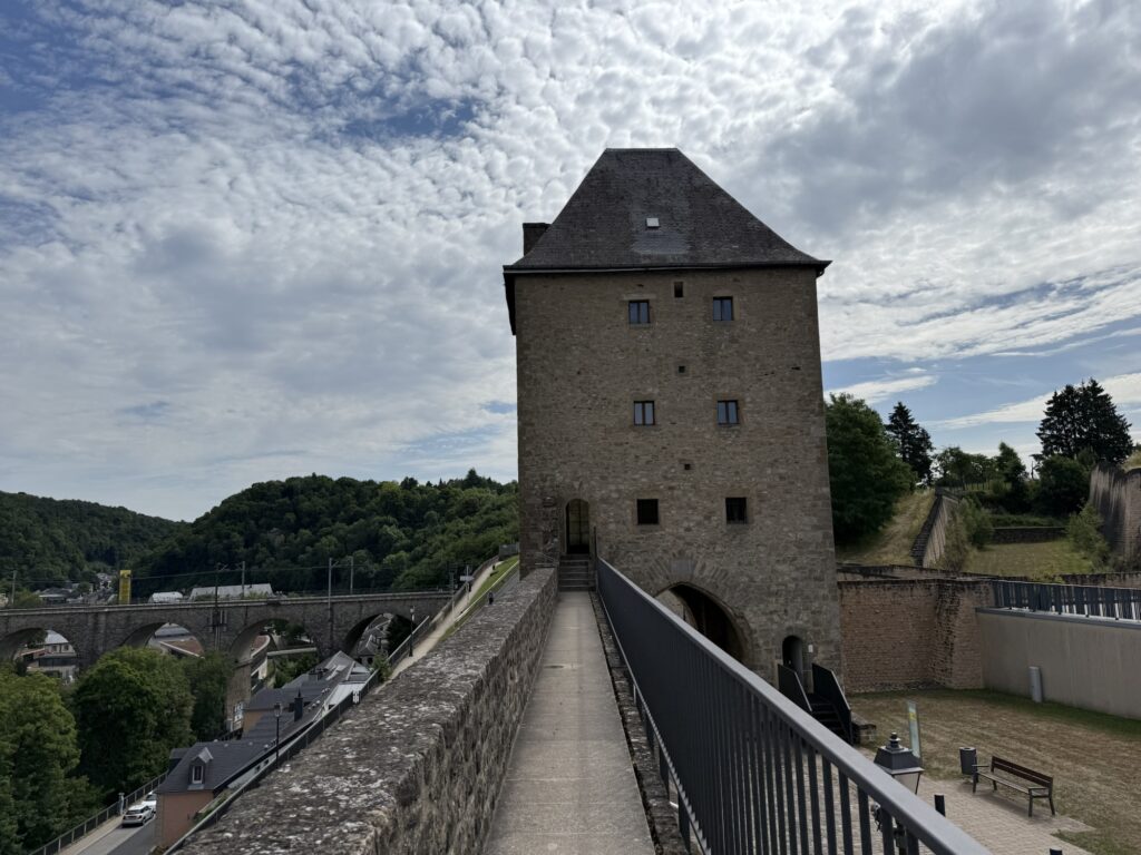
We walked along some fortifications which was part of the Tour Jacob or Rham-Plateau, which we came back to to walk through later.
A main train track is connected between the two plateaus and across the valley by a very impressive bridge to connect the train lines.

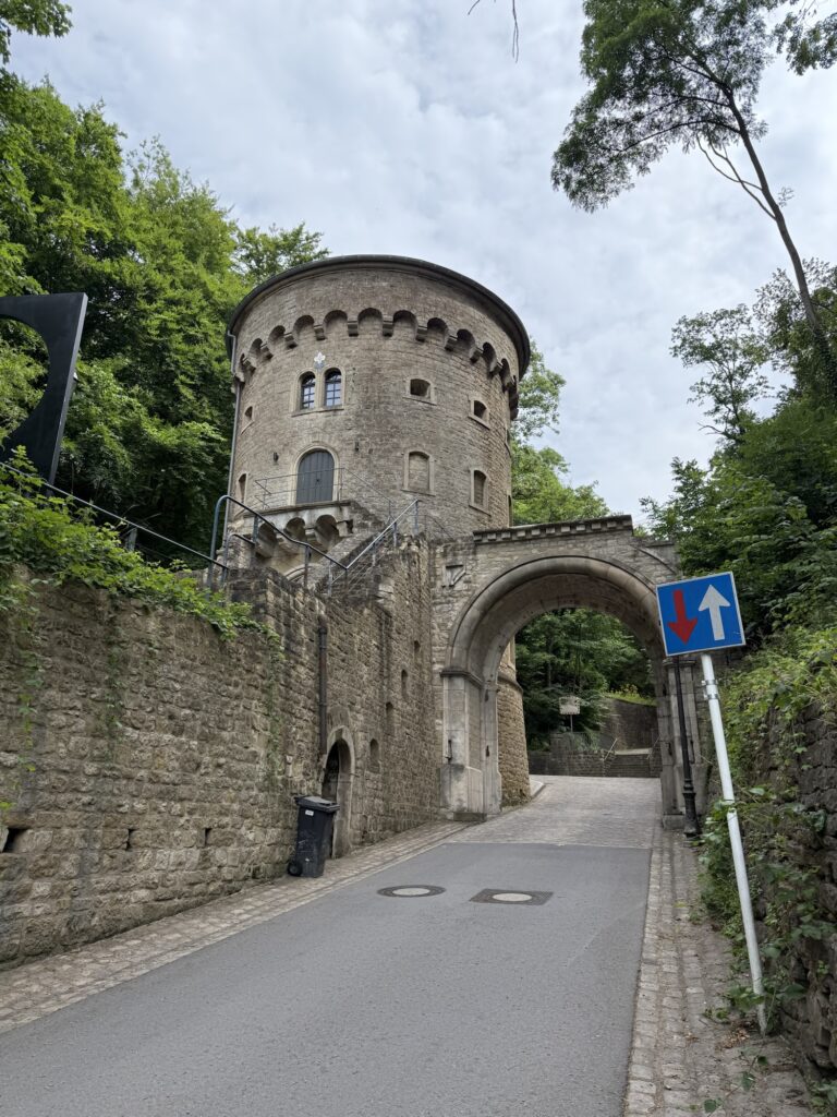
We descended down the valley between the two plateaus and walked up a road which brought us to a gate which we could image being an entry point into the great city at one stage. With gates and a guard tower standing watch for people trying to enter the city.
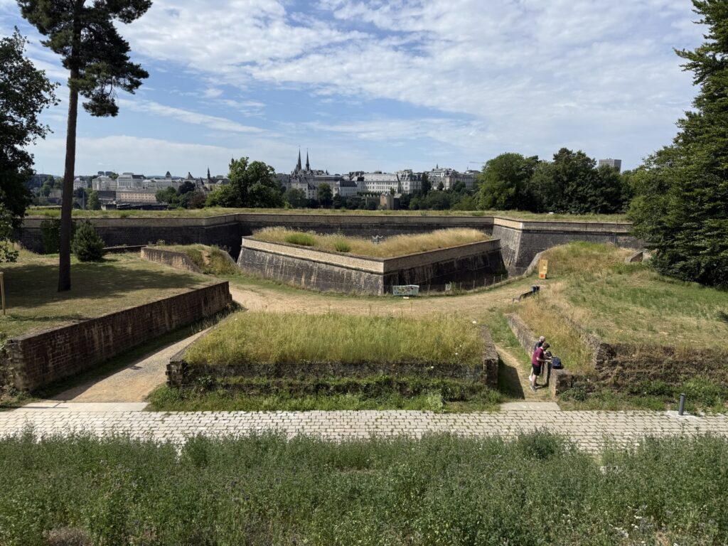
There were many layers of fortifications around Luxembourg. As we walked back up the hill we could see where the wall connected to cliffs to protect the city. It made me want to read about the history of the city and if it was ever under siege. Something I will likely do when I next have no mobile service, I like to download wikipedia sites for aeroplane flights.
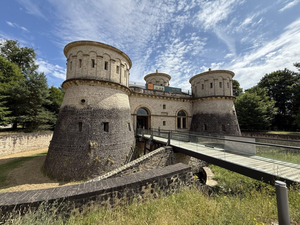
We came up to a place called Fort Thungen. It was established in 1733 I read. We found some small caves beneath it when we imaged soldiers or captains camping in it. There were some pavers laid in a style of a bed which I imagined it was still in use today as a camping location.
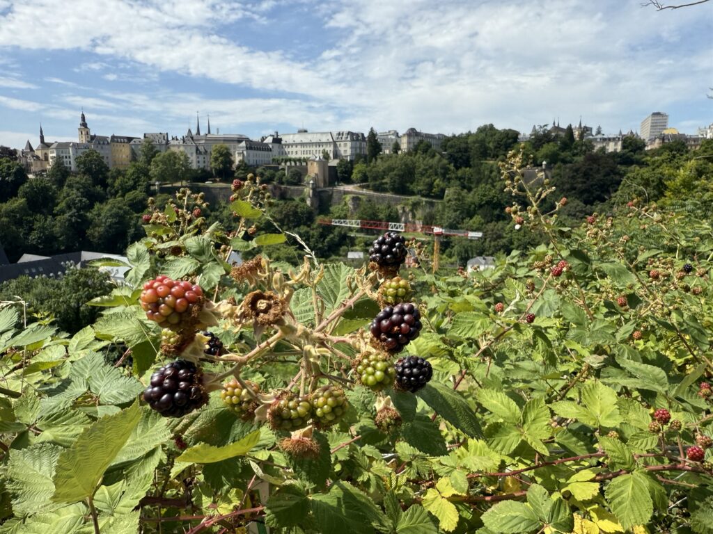
I tried some of the first Blackberries that we had found that were starting to turn ripe. Blackberries were everywhere in Luxembourg it seemed.
There were old structures everywhere around the place that must have been large towers at one stage.
We ventured around to find some lunch. We were walking very slow. This whole tour was meant to be a total of 6km, but we had already achieved that distance by this stage and we were thoroughly enjoying ourselves.
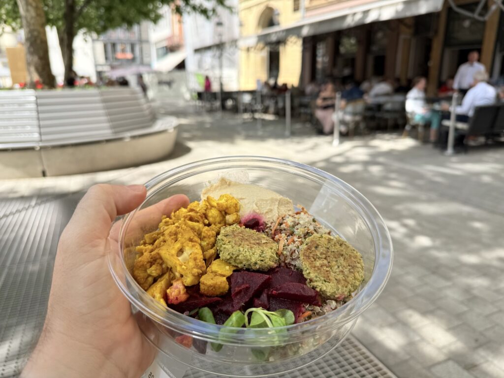
We ventured into town off of the AllTrails track to get lunch and decided to get the exact same style meal as yesterday. We had struck gold with these meals from the Monoprix supermarket chains in Luxembourg. These meals were so great we once again had them for dinner. Below is my cauliflower curry meal. I also had some fruit salad. Mitchell also got one of these but I didn’t get the name or photo.
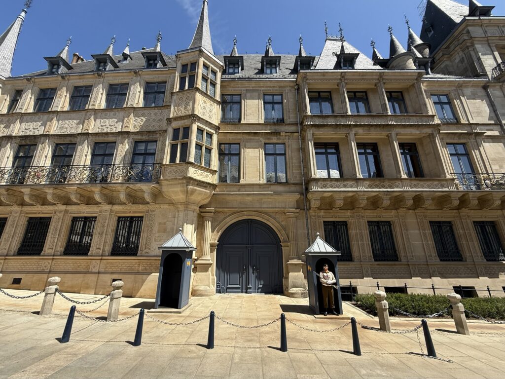
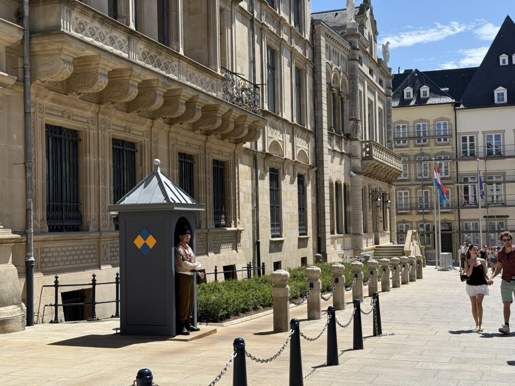
We saw the Grand Ducal Palace when in town getting lunch. There was one guard on duty today and no flag flying above the palace, which normally indicates no one is home today.
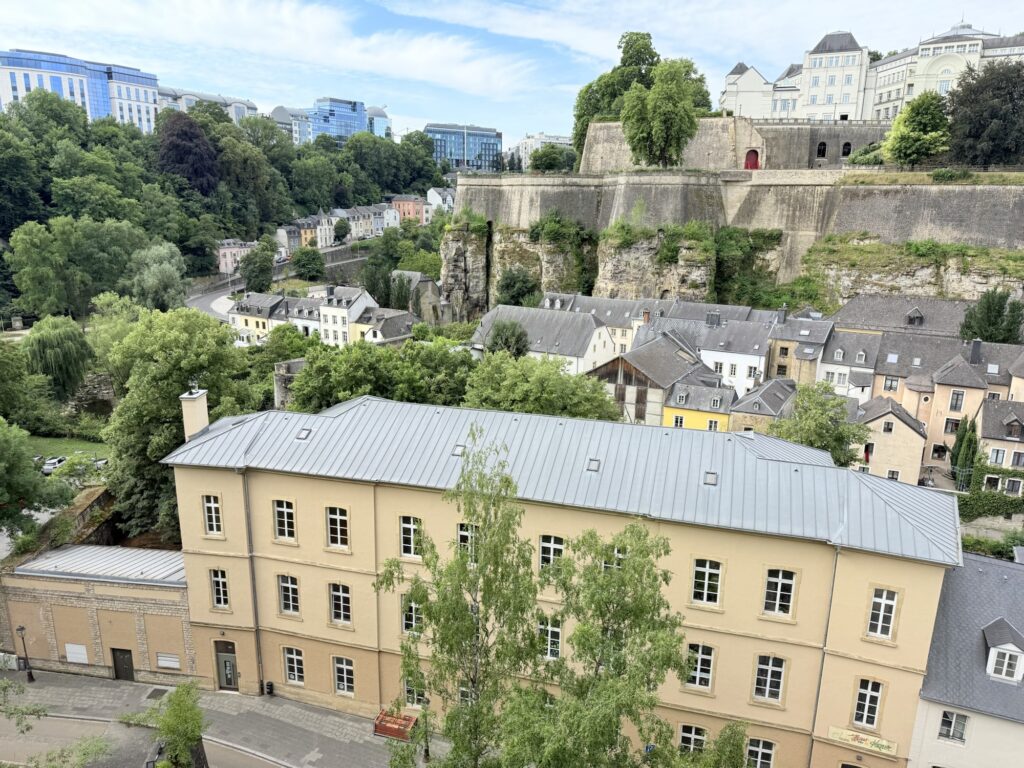
After lunch, we wandered along the fortified cliffs and enjoyed the view of the lower city. We took photos of Neumunster Abbey. This Abbey has been around since 1606 when it was restored after a fire in 1542.
Following this, we visited another park where Mitchell had a nap and I ventured off to find him a pen so we could write some more post cards. Mitchell is now travelling with a pen of his very own to use on his travels. My pen was in my backpack which I left at the hotel today.
We came across a protest in the streets of Luxembourg today. It was the second demonstration we had seen while in Europe. Mitchell very much wished to see it and I took a video below.
On our way home, we went back through the Tour Jacob, or Plateau du Rham, another fortified area which we could see guarded an upper area of the city. We walked along a path which I imagined was the main entryway into this part of the city which would have had archers on the walls if it was ever invaded.
Following this, we went back to the Monoprix supermarket to get another dinner of the same variety. These were proving cheap and very delicious. We hope they are available in the next stage of our journey.
Tomorrow is a big travel day. We arrive late in the afternoon at the next point in Mitchell’s planning. We think we might walk from our destination in Switzerland into Liechtenstein, it should only take about 2 hours on our arrival at 4pm. But we shall see.