Having had a fairly good night sleep for myself, despite the church bells ringing every hour through the night with a dedication that could only be described as religious, Mitchell once again had a plan for the day.
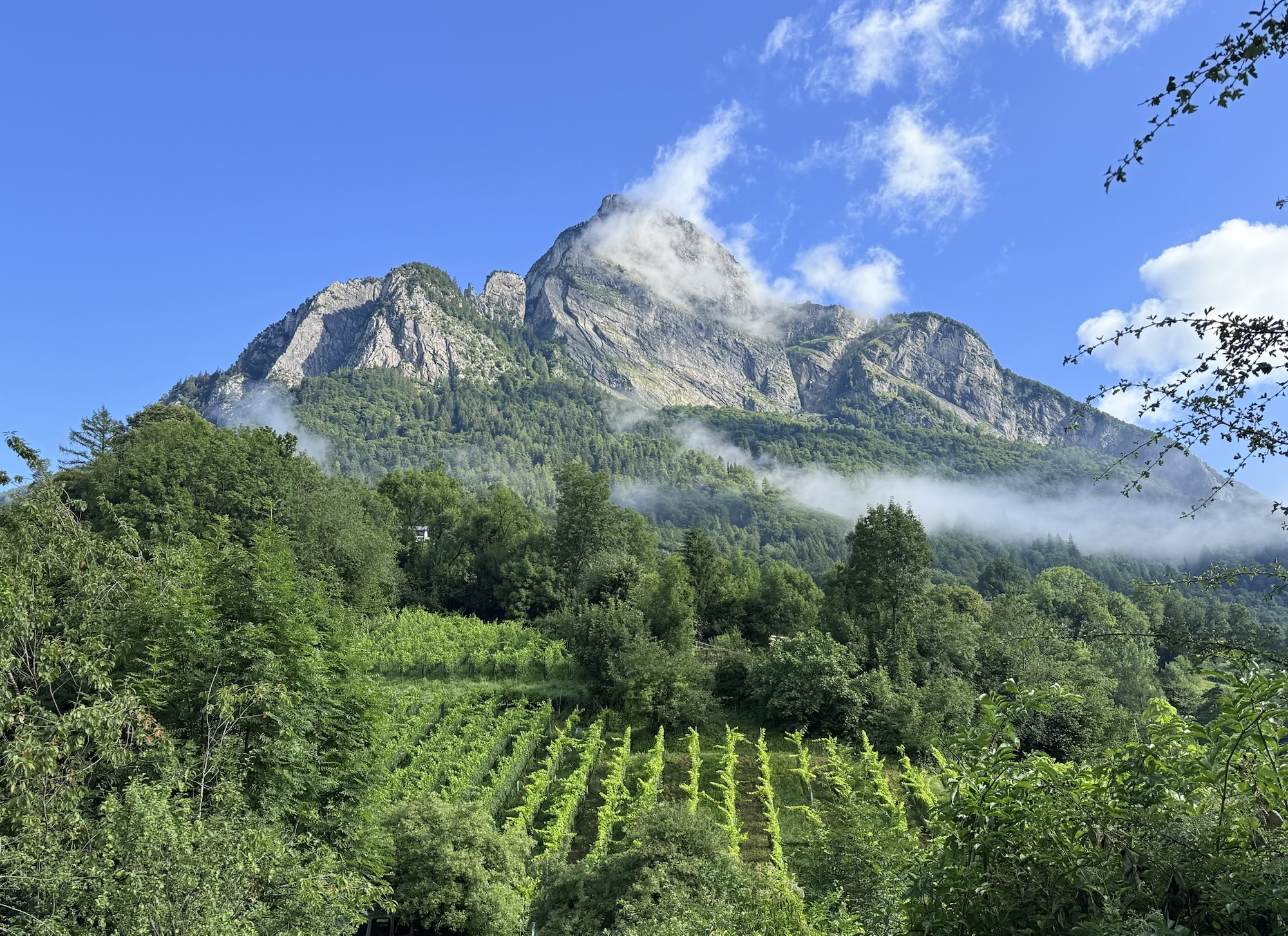
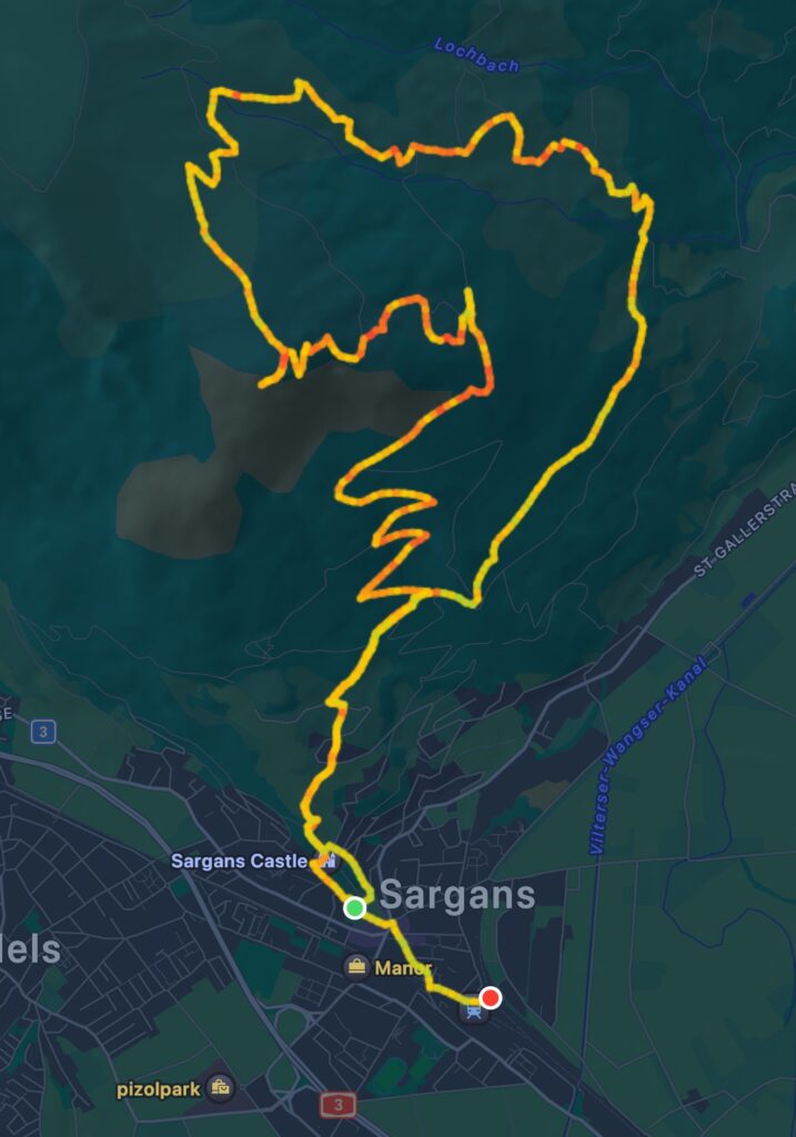
Mitchell had brought us to the Alps to climb mountains and this is exactly what we did today. It was a mighty feat that we needed to set our minds to. The track that led to the top of The Gonzen, a mountain that shadows across a neighbouring town called Sargans.
We caught a train to the town of Sargans. As I looked up, I could see the peak, it was a mighty sight and somewhat concerning as I wasn’t sure that I had climbed a mountain so big before. My regular climbing on Mudgee’s Three Poles Hill would no doubt be important training, but would it be enough?
We got supplies from the Co-Op shopping centre in Sargans. I took with me some pesto pasta and two (2) Schoggiwegglis along with two drinks. Schoggiweggli’s are milk buns with some chocolate bits in them. I ate one of them for breakfast while Mitchell found a coffee (given I drank his coffee this morning not realising we only had one pod for the machine). I bought him some coffee sachets for tomorrow as well.
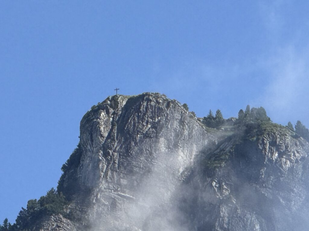
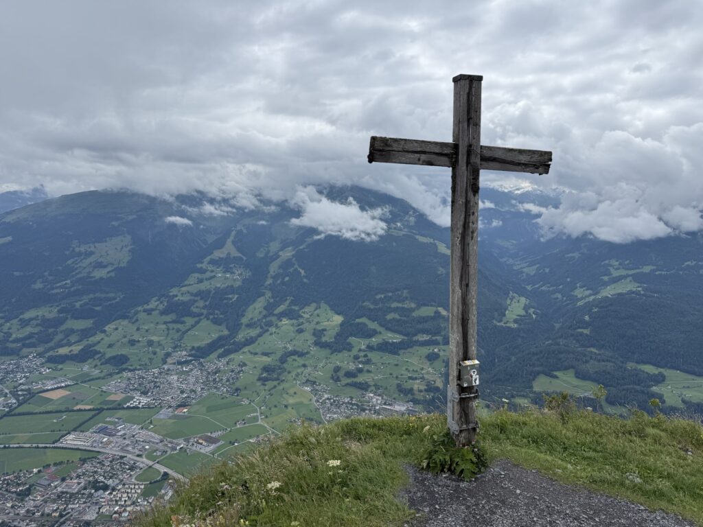
Based on information available in the AllTrails app, this trek up would be a total of 15km return. It would require an elevation gain of 1.3km of climbing, being 4,265 feet. As Sargans was already 480m above sea level, this would put us at 6,003 feet above sea level once at the summit. As we looked up, we zoomed in on our final destination, being a cross at the summit.
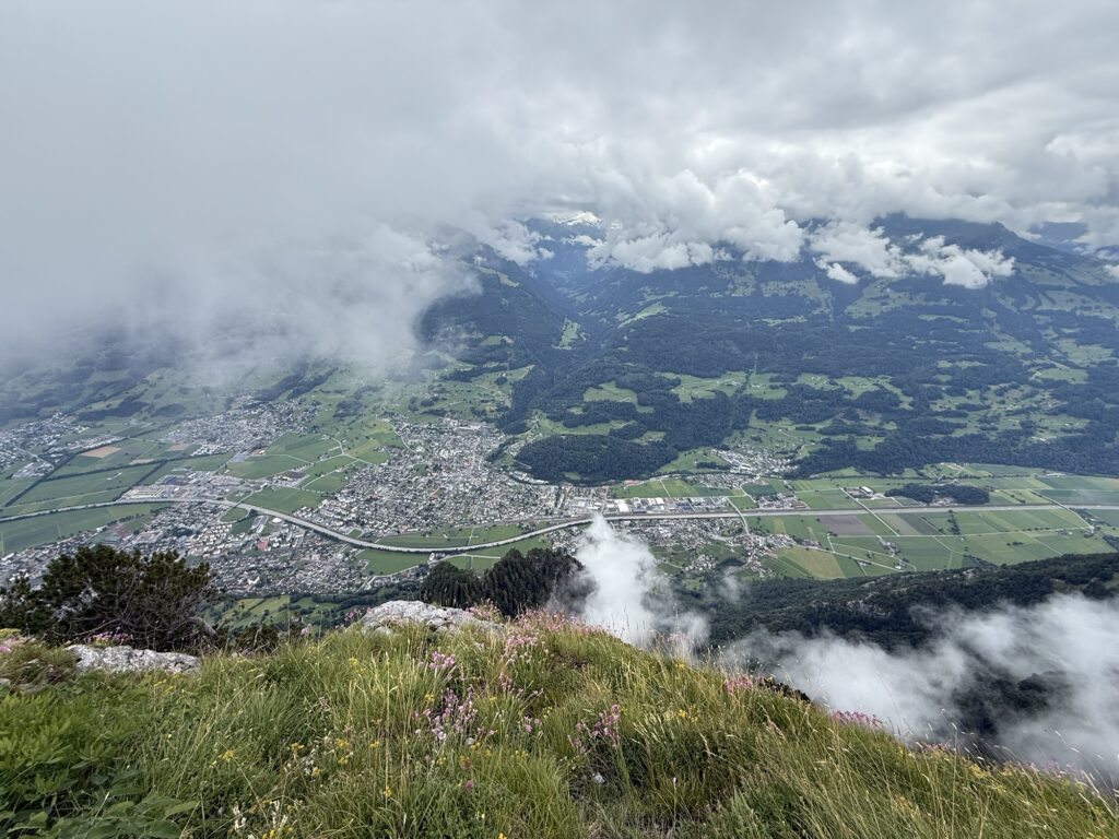
Our ascent started at around 9am, we were taking it slow to start and to not over exert ourselves. We had all day and planned to take all day. We were very quickly walking amongst the clouds and there were some very nice scenes as we climbed The Gonzen.
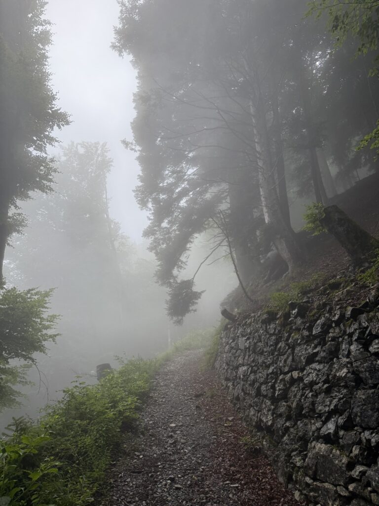
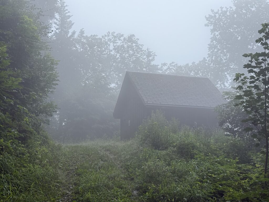
As we got higher, we saw two other walkers. After these initial encounters, we did not pass anyone else on the route we took up the mountain. We passed some huts which are everywhere around Switzerland. It doesn’t matter how high you are, there are always small huts and sheds about.
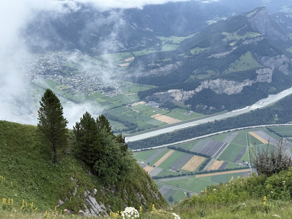
The path we took up the mountain led us to a ladder which I was not a fan of. We did not come back this way and plotted our own path back. The path we took back was much more popular and we saw many other walkers on the trail.
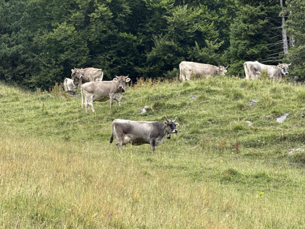
After the ladder, we encountered some cows on the path. Mitchell gave it a go in walking up to them but they did not seem to pleased with that. We took a self-made detour around the cows and left them in peace. We were really high up and very surprised to find livestock on such steep slopes. It would not be easy farm work here. The cows had bells and the sound of bells in the hills became something quite regular for the rest of the journey, even on our alternate route down.
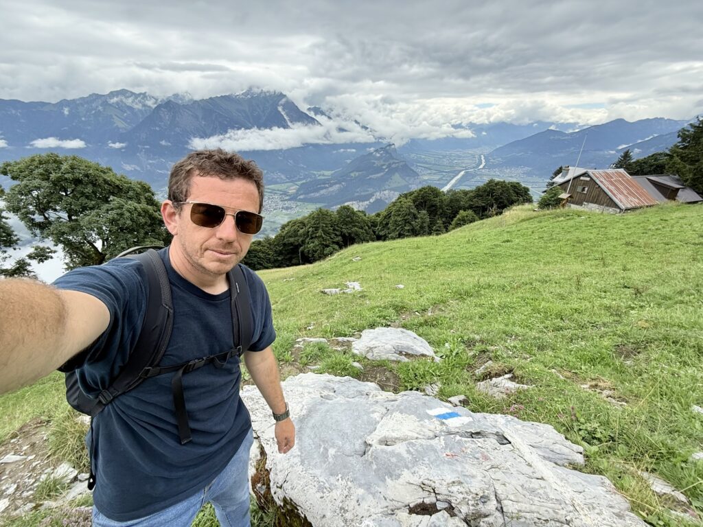
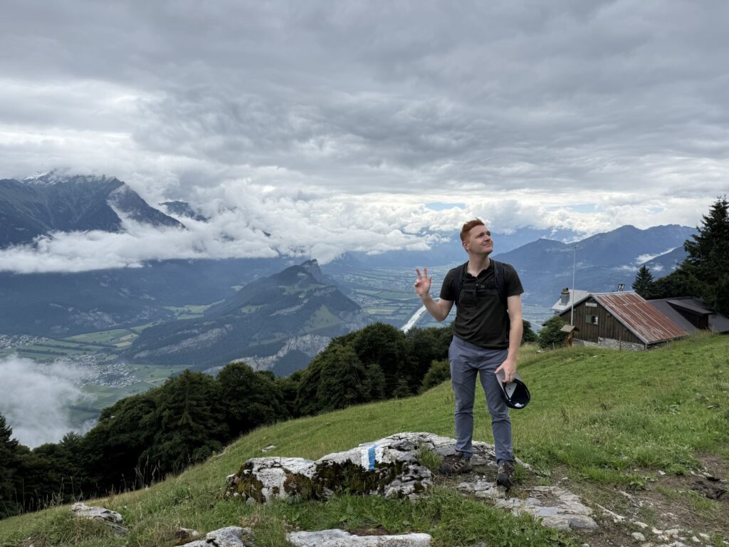
On this side of the hill, we took some selfies.
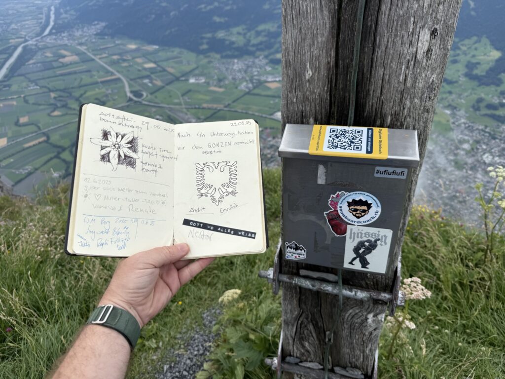
We ventured on and after another hour or two we finally reached the top. We had lunch here as the clouds came and went. Some clouds rolled over the top of the mountain or were pushed straight upwards. I took a Timelapse of the clouds but it didn’t really demonstrate what we were seeing.
I took a series of photos from the summit, I will add them below.
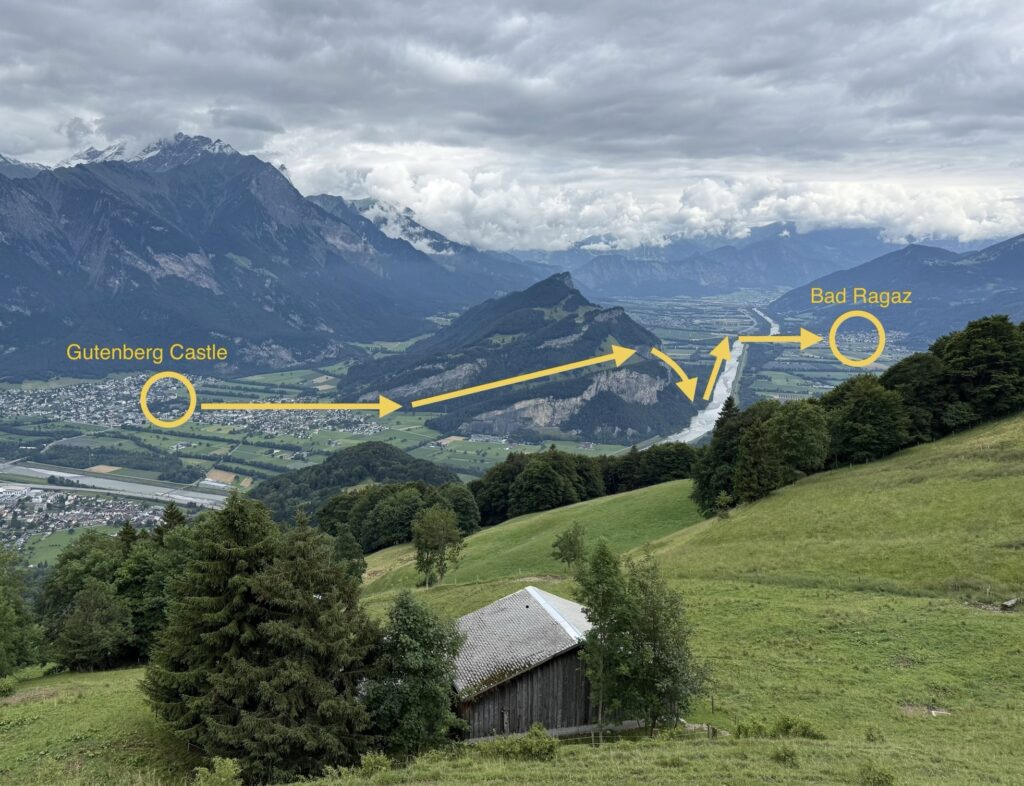
On our way back, I could see clearly the walk I took yesterday from Gutenberg Castle all the way to our next accommodation in Bad Ragaz. Yesterday’s walk was 11km.
We were mighty tired by the time we got back down to the train station. We wanted to just keep sitting on the train and not get off.
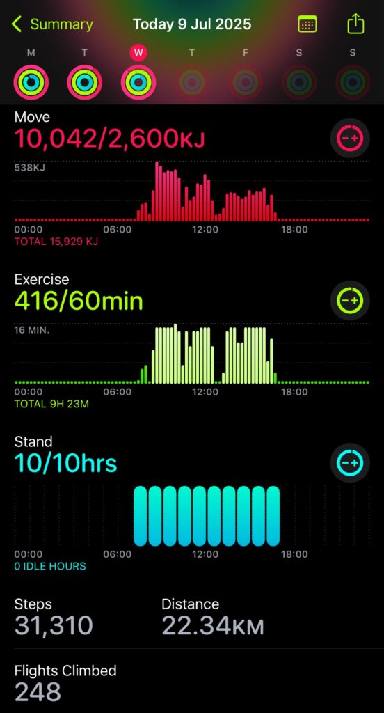
The route itself as 18.47km in total, after we took a different path back down to avoid the cows and ladder. My recorded workout was 7 hours and 44 minutes. As predicted, we gained elevation of 1,344m according to the watch.
Once we walked back into Bad Ragaz, I had completed the largest kilojoule burning day I have recorded since having an Apple Watch. For the day, I burned over 15,929kj for the day, walked 31,310 steps, and walked 22.34km. This was not the most steps, but it was by far the highest I have walked.
We had some server issues today. Windows update was the problem again. A mySQL database corruption which luckily resolved itself after a restarting. I’m not sure how long the blog was offline for.